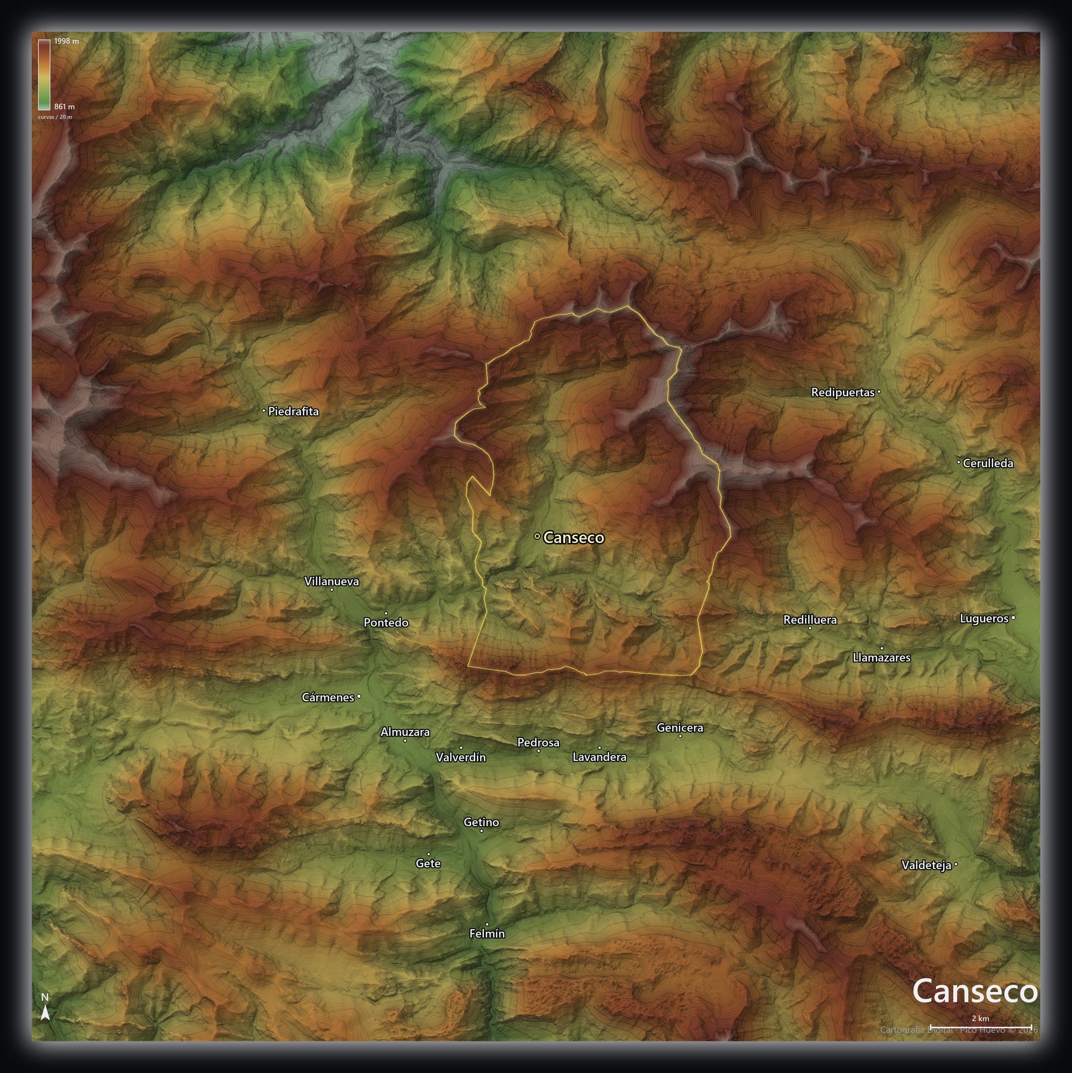
Explore the terrain layer by layer
One map of the valley with layers you toggle at will: elevation tinting, hillshading, contour lines, the drainage network, slopes and the viewshed from each summit. Move the sun to watch the shadows sweep in — in winter or in summer. Everything is precomputed from the terrain model, so it switches instantly.
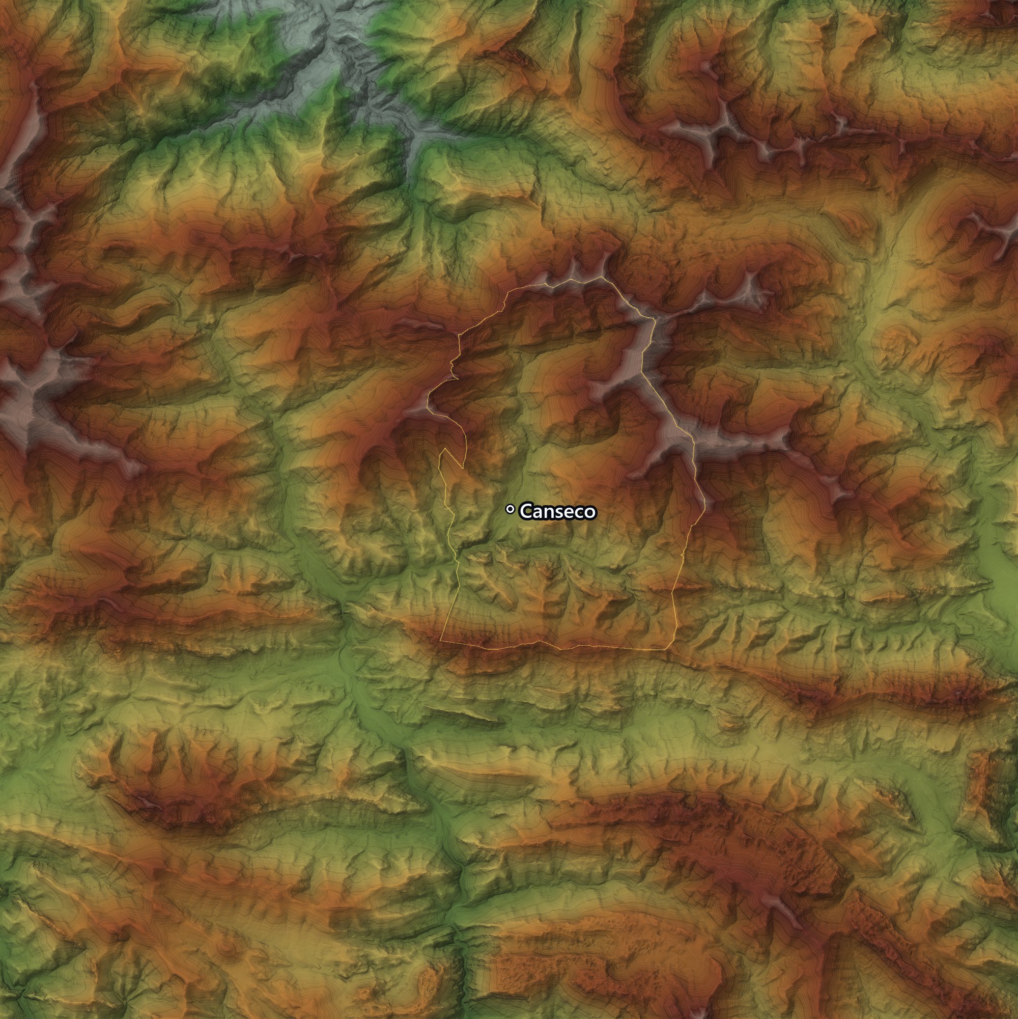

Precomputed layers from the 5 m DEM, toggled instantly · scroll, pinch or use +/− to zoom, drag to pan.
What the terrain is like
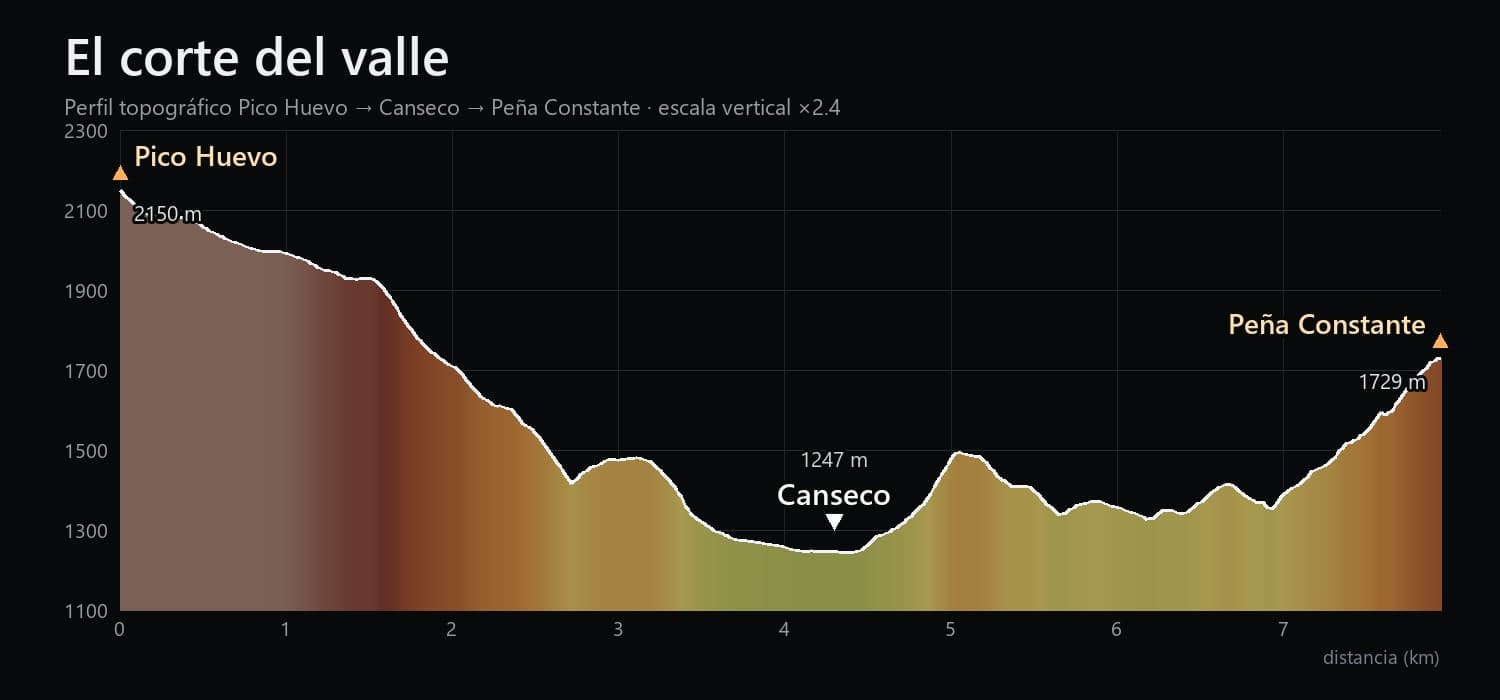
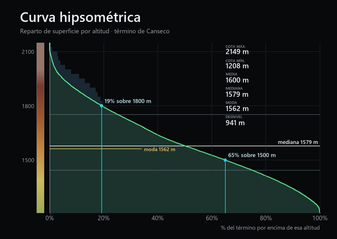
Canseco sits in a glacial valley of the León central mountains, between the 1,208 m of the valley floor and the 2,149 m of its summits. The flyover circles that terrain in 360°; the cross-section cuts it from summit to summit, with the village at the bottom; and the hypsometric curve sums up how much land lies at each elevation.
The Canseco boundary

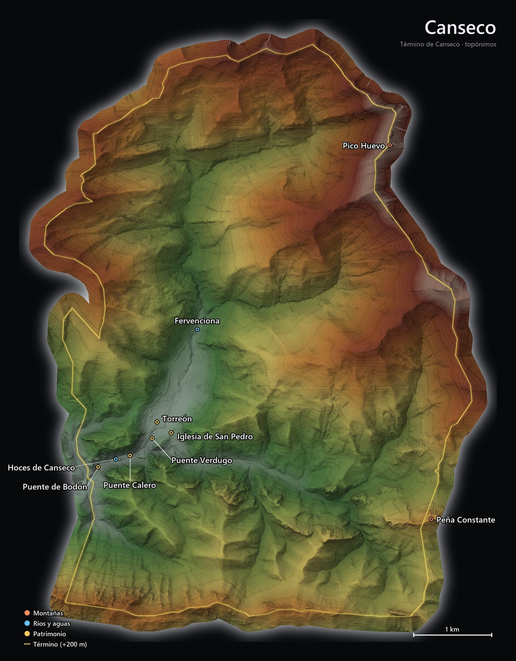
The boundary of Canseco carves out a parcel of mountain with its place-names: Pico Huevo and Peña Constante on the heights, the gorge and the Fervenciona on the water, and the village with its medieval tower, the church of San Pedro and its historic bridges.
Your Canseco poster
Pick the place-names you want on the map, preview it and download it at full quality, ready to print at A3.
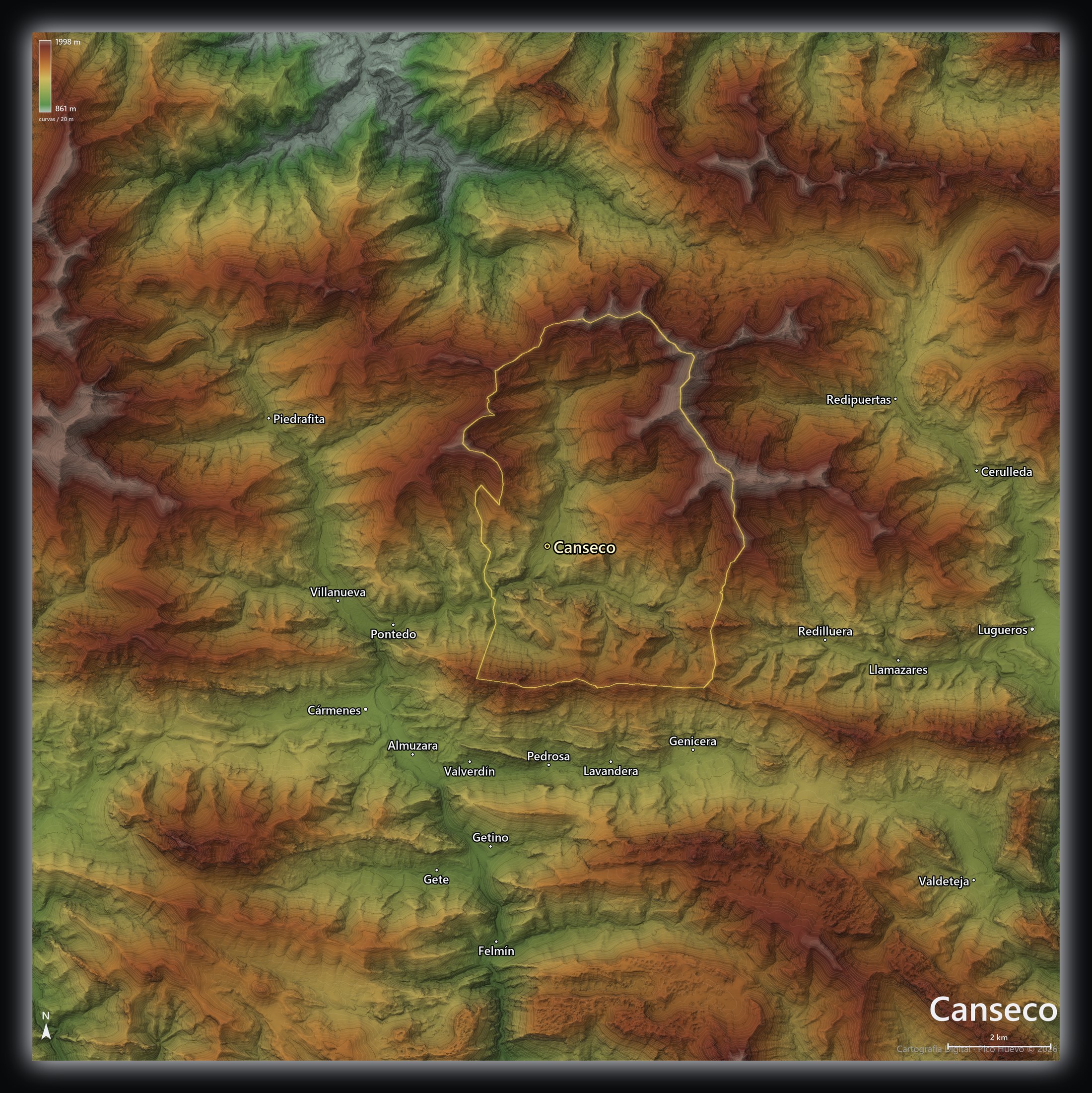
Produced from the 5 m Digital Terrain Model (MDT05) of the Spanish National Geographic Institute (IGN) and the Canseco boundary (OpenStreetMap). The same model that powers the 3D terrain of the place-names map and the trails.